This post will show you a scenic drive in New Zealand, down the South Island West Coast.
We will take the State Highway 6 from the Pancake Rocks and drive south towards Lake Matheson and the glaciers of Franz Josef and Fox. Further south on our 370 km drive we will come to Haast, the place where to turn inland.
What is driving on the South Island West Coast like, in the remote region of green farming areas, rugged coastline, stormy seas and green rainforests?

Lake Matheson and a reflection of Mount Cook on the South Island West Coast
The west is green, beautiful and backed by the highest mountains of the country. The mountains make West Coast a place far away from everything: wherever you go, the distances will be long. Only 40 000 people of New Zealand’s total of 4,5 million have settled in this isolated area.
No cities exist on the West Coast, only isolate houses and small settlements. At the time we were visiting, they didn’t even have proper internet connections outside the villages.
West Coast as a Part of Our South Island Trip
The West Coast is a part (section number 2) of our South Island round trip, for which purpose we rented a campervan.
To get to the west we crossed the mountains along the Arthur’s Pass road from Christchurch, and to leave it behind we took the road to Queenstown across the Haast Pass. These are the two main roads linking the West Coast to the rest of the world. Plus the third road in the north, the Buller Gorge road from Nelson.
If you want to read about how we arranged our New Zealand campervan trip, check out the post New Zealand in Campervan: Christchurch to Greymouth.

On the way to New Zealand’s wild West Coast
And finally, for all posts on our South Island road trip check out the main post New Zealand South Island Road Trip in 11 Days.
South Island West Coast Drive on the Map
The map shows our South Island West Coast driving itinerary, 5 hours of driving without stops – which I, of course, don’t recommend. You will want to stop, often.
We stayed three nights on the West Coast, first in Greymouth in the north, then in Franz Josef Village in the middle and last in Haast in the south, before turning inland.
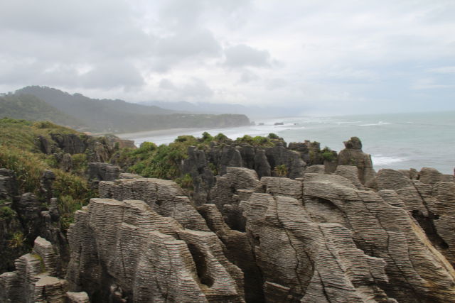
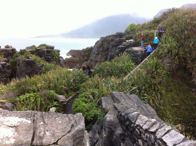
I will show you West Coast attractions from north to south. The first place to see is Punakaiki and its Pancake Rocks:
Punakaiki Pancake Rocks

The South Island West Coast drive: Punakaiki pancake rocks
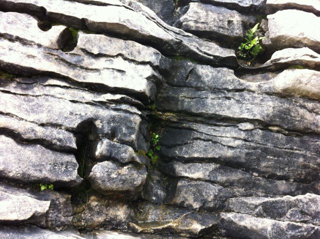
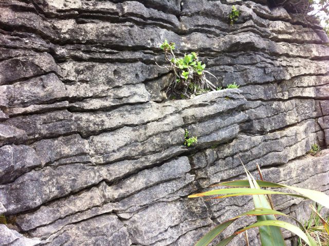
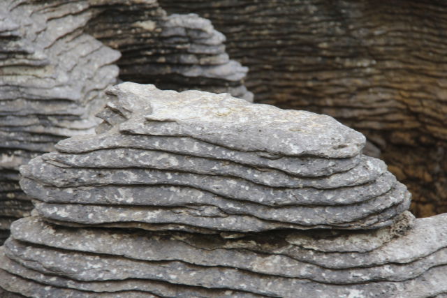
Have you ever seen piles of petrified pancakes? I have. In Paparoa National Park near the small village of Punakaiki. These piled stones really look like pancakes, but they are layers of limestone, separated by thin bands of soft stone.
There are thousands of piles like this in Paparoa, which looks dramatic. The piles have not been like this from the beginning, no, sea storms and rain have shaped them during thousands of years and will form them even more in the future.
How to See the Pancakes: Dolomite Point Walk

Pancakes and a cave in the Pacific Ocean
To see the pancakes you only have to take a 25 min loop walk from the visitor centre located on main road. As most of the pancakes are in a place called Dolomite Point, that’s where you should go.
The Dolomite Point walk is a very easy one and first part of it is accessible.

Petrified pancakes of Punakaiki
But look at these layered limestones, Paparoa National Park pancake rocks!
To view the small photos in a bigger size, click on them.
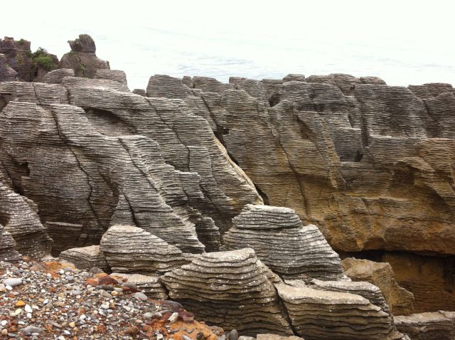
The pancake rocks of Paparoa National Park, South Island West Coast.

Pancake rocks and a piece of rainforest
As this is a national park, there are more walks, both long and short:
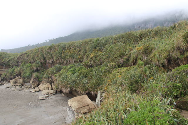
Truman Track Rainforest Walk

South Island West Coast drive: Truman Track rainforest
The 15-minute Truman Track is a rainforest walk that takes you to a rugged coastline with caverns and blowholes.
At high tide and during storms the caverns along Truman Track turn to blowholes. That will happen when the wind pushes ocean water into the cavern from where it explodes high up with a spray.

Walking on Truman Track, Paparoa National Park

Truman Track vegetation on the South Island West Coast
Punakaiki Beach

Punakaiki, a South Island West Coast beach
The short Truman Track takes you to the Punakaiki beach. The powder beach looks inviting, but the weather doesn’t make you want to swim. It’s cold and rainy, like on many other days in this area. The South Island West Coast is a high rainfall area where it rains 5000 mm a year.

Then there’s one more trail, a 2 hour walk to a limestone formation called the ballroom overhang. However, to see more of the West Coast we skipped that walk and headed 43 km south to Greymouth, driving through a deep rainforest.
Punakaiki to Greymouth

Driving in New Zealand: road through a thick rainforest
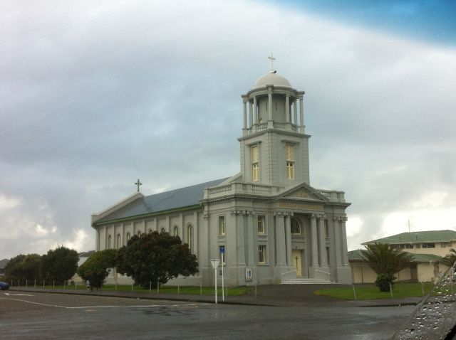
Greymouth with its 13 500 inhabitants is the largest settlement on the West Coast. As an old gold and coal mining town it still is the center of a coal mining area.
In addition, Greymouth is a greenstone town. It is that since the 14th century when the Maoris settled in the area. They originally came to West Coast for greenstone, also called jade, that they found at the mouth of the Grey River.
To learn about greenstone, visit the Greymouth Jade Boulder Gallery.

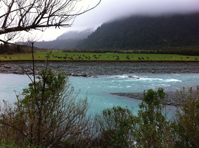
West Coast cattle
As the biggest resort on the West Coast, Greymouth has developed to an adventure center that offers commercial tourist activities: drafting, dolphin watching and so on.
But we didn’t want to take any tourist activities in this weather and took the State Highway 6 from Greymouth to the next settlement that has a nice name, Hokitika.
Hokitika

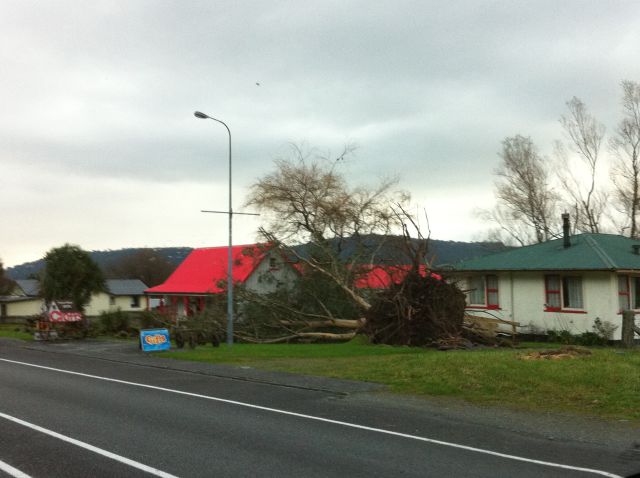
The beach of Hokitika on a stormy day
Hokitika is in a stormy location. At the time we were visiting, it was rainy and windy. The week before there had been a huge storm cutting trees in forests and gardens in pieces.
After all, this rainy weather is not bad at all, knowing that there has been a time when 32 shipwrecks occurred on the Hokitika coast, all within three years.
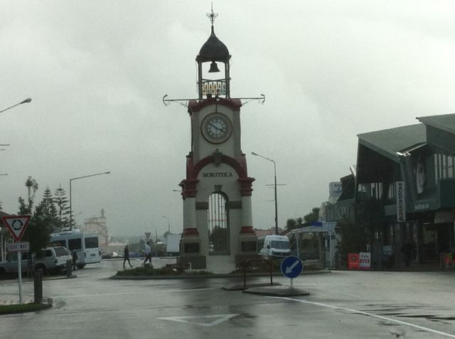
Photos of Hokitika, the New Zealand West Coast drive
During the gold rush Hokitika was an important town. Many buildings still remain from those days, like the clock tower and the Carnegie Library that you can see in the photos.
To see all 22 historical buildings that exist in the town, walk a marked heritage trail, and to see glowworms, take a glowworm walk.
And since Hokitika, too, is a tourist town, there are more attractions for you: an aquarium, a gold-mining museum, a kiwi centre and jade galleries.
Hokitika to West Coast Glaciers

Driving down the South Island West Coast
But it’s still 150 km to the glaciers where we booked the next night. So we have to drive.
On the South Island West Coast, most roads are good and above all, there’s hardly any traffic. You will have the road for yourself.
I like the place names in road signs : Lake Mahinapua 10 km south of Hokitika, followed by Pukekura, Harihari, Whataroa.
The village of Ross 28 km south of Hokitika has a gold-mining museum that shows the largest gold nugget found in the region.

A typical New Zealand road
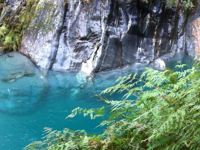
West Coast Jade Rivers

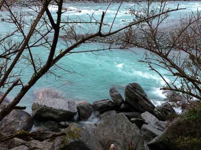
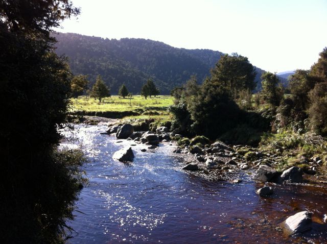
South Island West Coast rivers look like this
The South Island West Coast has many turquoise rivers letting water from the mountains flow to the sea, and even today many of them contain jade.
Yet it’s not the jade that gives the rivers their colour, it’s small particles that come from melting glacier ice. West Coast rivers are mountain rivers and we are approaching the glacier mountains.
More river photos
Franz Josef and Fox Glaciers

Franz Josef Village, New Zealand
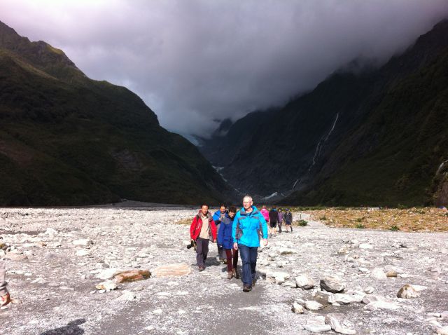
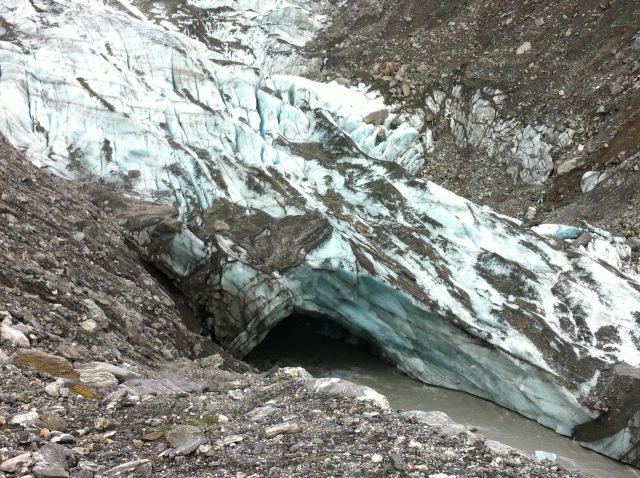
And then, the mountains got higher and we reached Franz Josef Village, a small mountain village where we stayed a night in the rainforest, bathed in hot pools and looked for kiwis in a kiwi house. And above all: we hiked to two glaciers, the Franz Josef and Fox Glaciers.
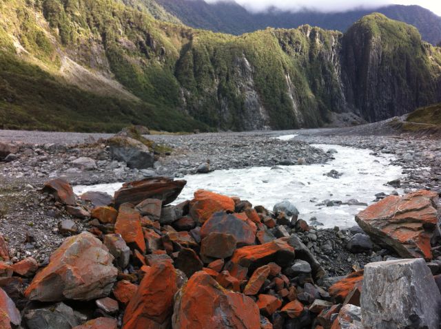
Franz Josef and Fox Glaciers
These are the only two of the 140 New Zealand glaciers that reach down from 3000 m to the rainforest at only 250 m.
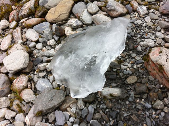
So we walked to both glaciers. It was not a long walk so almost anyone can do it. You can read about the glaciers and our glacier walks in my post New Zealand: Franz Josef and Fox Glaciers. The post also tells more about Franz Josef Village.
In this post we will continue our trip south and the next attraction is only 6 km from Fox Glacier Village: Lake Matheson.
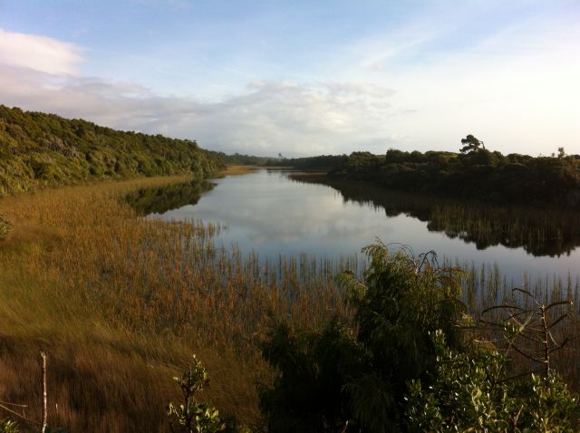
Lake Matheson

South Island West Coast scenery
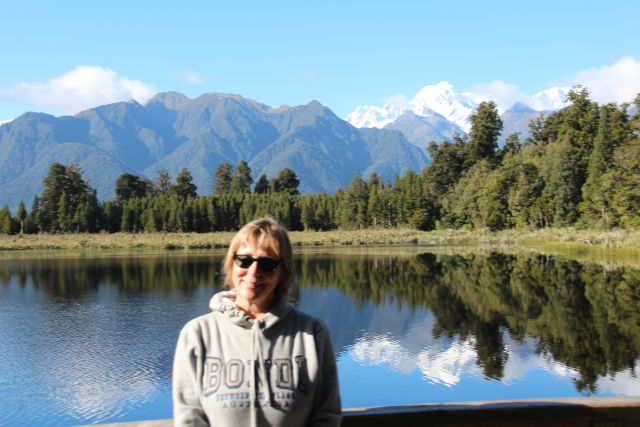
The Glacier country also has lakes and the most famous of them is Lake Matheson. Lake Matheson is what you see on all New Zealand postcards. On calm days the lake shows stunning mirror-like reflections of Aoraki Mount Cook and the other snow-capped tops next to it.
They say the reflection looks best in the early morning so we made a morning trip to Lake Matheson, the reflecting lake on New Zealand South Island West Coast.
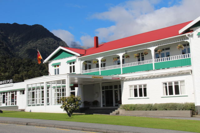
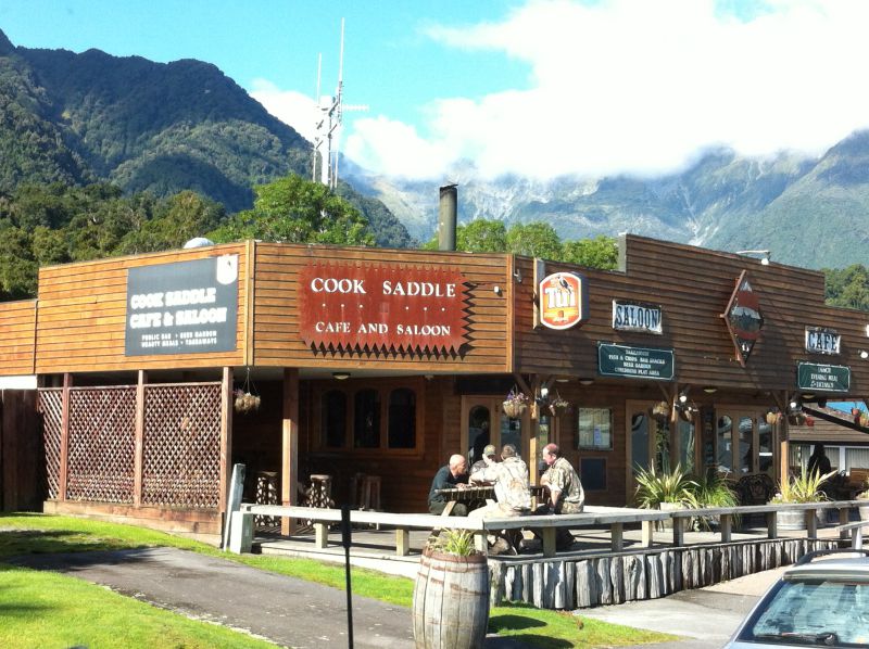
These photos are from the village where you turn to Lake Matheson from State Highway 6. We saw some pubs where walkers were sitting outside having their breakfast and some other buildings looked like hotels.
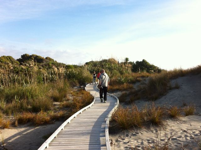
Walking to Lake Matheson

New Zealand West Coast drive: view from the Lake Matheson road
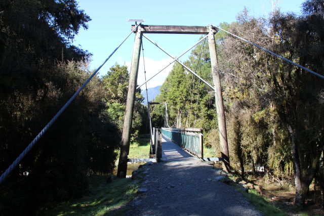
To see Lake Matheson and the postcard view: take a 40 min walk (20 min one way) from the Lake Matheson Cafe car park. The track crosses the river to an ancient rainforest with kahikatea and rimu trees, the exotic forest makes you believe you are in a fairytale forest. Never seen a forest like this!
Less than halfway along the lake is the Jetty viewpoint where you can watch the world famous reflection.

Lake Matheson from the Jetty viewpoint
Can you see the dark brown colour of the river and the lake? That’s what makes the reflection so special. The dark colour comes from organic humus in the water.
My best Lake Matheson postcard photos:

Lake Matheson view to Aoraki Mount Cook and Mount Tasman
Enjoying Lake Matheson on a sunny morning

Aoraki Mount Cook, 3 724 m, and the Fox Glacier seen from Lake Matheson
If you like you can continue and take the circuit track around the lake. There are two more lookouts with similar views, the View of Views at the top of the lake and the Reflection Island on the opposite side.
The walk around the lake will take approximately 1,5 hours and it’s all the way forest.
More on Lake Matheson and the walkway on the Lake Matheson website.
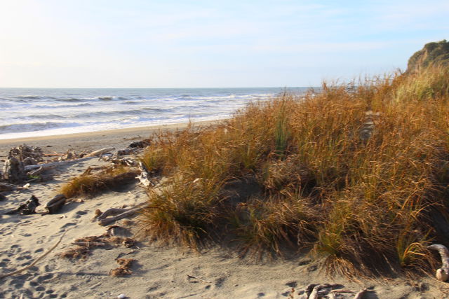
Bruce Bay and Lake Moeraki

Bruce Bay on the South Island West Coast
After Lake Matheson the State Higway 6 runs through a forest until it meets the Tasman Sea at Bruce Bay at the mouth of the Mahitahi river.
The pretty beach is partly sand, partly moraine from the glaciers and it must be a windy place most time of the year. At least there’s tons of drift wood that Ocean waves have carried to the beach.
From Bruce Bay it’s still 80 km to Haast, forest again. And then, in the middle of the forest there’s a lake with a strong blue colour, Lake Moeraki.

Lake Moeraki, the blue lake
Knights Point Lookout

Knights Point Lookout further down the South Island West Coast
Just south of Lake Moeraki is the scenic Knigts Point Lookout with great views of the Haast area coastline and the Tasman Sea. The viewpoint was built in 1965 when the road from the glaciers to Haast opened. So the road opened first in 1965?

Enjoying the views
If the timing is right you might spot seals, dolphins and penguins.
There should be a penguin colony and the best time to watch them is August to November on late afternoon or early morning. Penguins only exist in the southern hemisphere so try to see them once you are in New Zealand.
Ships Creek

One more stop: Ships Creek
Ships Creek is our next destination, a wonderful place for a stop. There is a river mouth and a sandy beach with fine sand dunes and some driftwood. I liked the lagoon with dark brown river water.
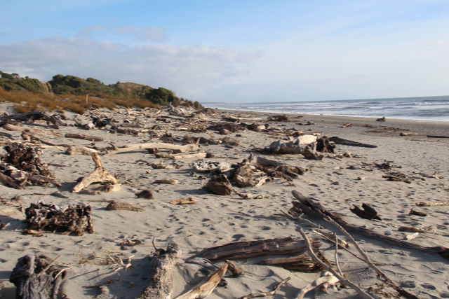
Ships Creek beach, South Island West Coast drive

White sand and a brown lagoon
Ships Creek has two short walks. The 30 min Dune walk takes you along the beach to a small dune lake and the Kahikatea Forest Walk, maybe a bit more than 30 min, brings you through a Kahikatea swamp forest to a forest lake with seabirds. This is a place for bird lovers!

On a nature walk
Ship Creek with its two beautiful nature walks is worth a stop. They have built good boardwalks on the dunes and through the dense coastal swamp forest so it’s very easy to walk here.
West Coast coastline
And our last West Coast destination is Haast, before State Highway 6 turns inland.
Haast

State Highway 6 bridge crossing Haast River
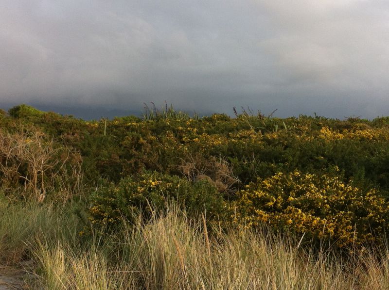
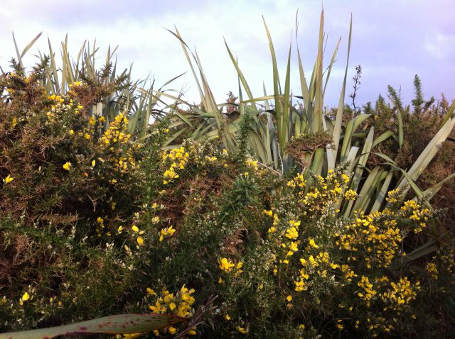
Haast really is a small community. It only has 300 inhabitants, one or two general stores, a gas station, some dining and accommodation for visitors – and a possum and merino gift store. So there’s not much to see in the township itself but the surroundings are magnific: the Haast area has been declared the South West New Zealand UNESCO World Heritage Area.
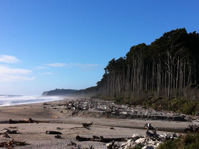
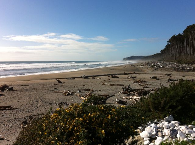
We arrived at Haast in the evening and continued our journey the next morning so there was no time for more activities than a walk on Haast Beach, along a side road to the fishing village of Jackson Bay (36 km south).
Haast Beach

Driftwood on Haast beach, New Zealand
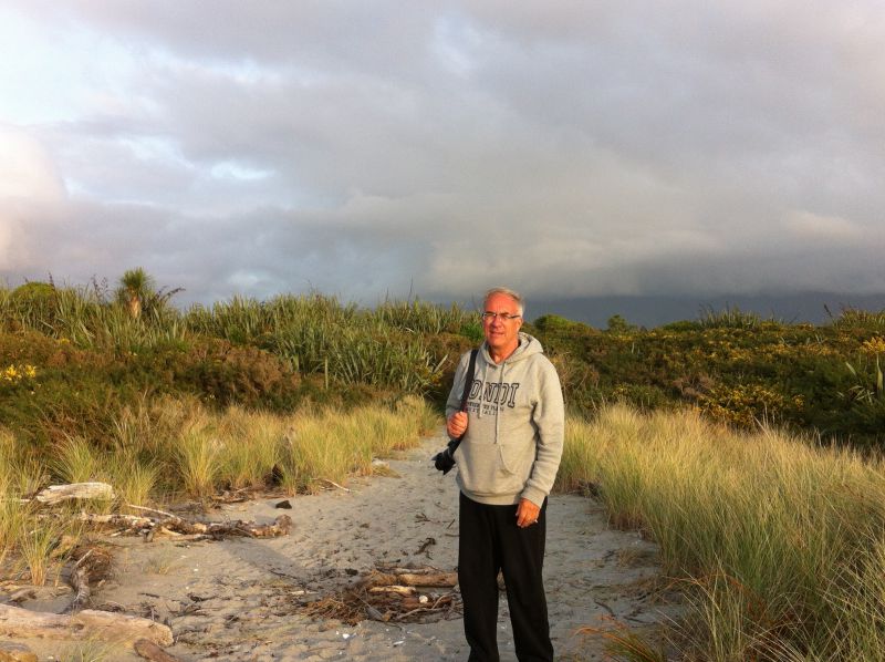
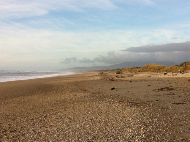
Walking along Haast beach, South Island West Coast drive
Haast is on the western edge of Mount Aspiring National Park. My next post will show you the UNESCO listed national park as we drive inland from Haast:
From Haast to Queenstown
To see how our journey continues from Haast check out my next post New Zealand Drive: West Coast to Queenstown.
The post contains more photos of Haast and in addition you will see the Blue Pools, the Southern Lakes and the towns of Wanaka and Cromwell – and Kawarau Gorge bungy jumping.
Driving from West Coast to Queenstown: Blue Pools
More on New Zealand Travel
This was section number 2 of our New Zealand South Island road trip. You will find our whole South Island itinerary and its all other sections here:

New Zealand South Island road trip in 11 days
Lovely website! I am loving it!! Will come back again. I am taking your feeds also.