Our New Zealand campervan trip now takes you from the South Island’s West Coast to Queenstown. We will follow the Haast River to Mount Aspiring National Park and see the amazing Blue Pools.
What else is there for travelers? The majestic Southern Alps with the turquoise mountain lakes Hawea and Wanaka.
From Wanaka we will take the Cromwell road to Queenstown and in Kawarau Gorge watch New Zealand Bunji jumping.

Blue Pools in Mount Aspiring National Park, New Zealand
This is post number 4 in the series of posts of our South Island road trip. You will find the rest of the trip on this page: New Zealand South Island Road Trip in 11 Days
West Coast to Queenstown: Drive Map
Drive from New Zealand’s West Coast to Queenstown on the map
The map shows you the New Zealand State Highway 6 from Haast to Queenstown. This is the southernmost road of the three that link the South Island’s west to the rest of the island. The other two are the Arthur’s Pass road and the northern route from Nelson.
The State Highway 6 first crosses the Southern Alps and after Wanaka uses river valleys and gorges on the way to Queenstown. We will begin with the southernmost West Coast village Haast:
Haast

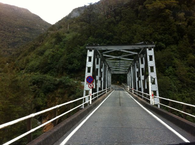
Haast bridge crossing the wide Haast River
This is a State Highway 6 bridge in Haast – yes, New Zealand highway bridges are like this. The Haast bridge lets you cross the massive river that we will follow up to the narrow Haast Pass higher up in the Southern Alps.
The pass forms a dividing range, where on the opposite side another river takes mountain water to lakes that exist on the other side. That one is the Makarora River and runs down to Lake Wanaka. We will follow that river as well, but first about Haast:
Haast, a Farming Country
Like all New Zealand Haast is a farming country, green and hilly and gets a lot of rain. At Haast we met nice farm animals:


Driving from Haast to Queenstown: the farming country of Haast
In addition, Haast is a well-known tourist area and popular with hikers. That’s because the little village makes a good base for exploring the nearby Mount Aspiring National Park.
The small community has some hotels, quest houses and holiday parks, and a couple of pubs and shops. And plenty of beautiful rural scenery:

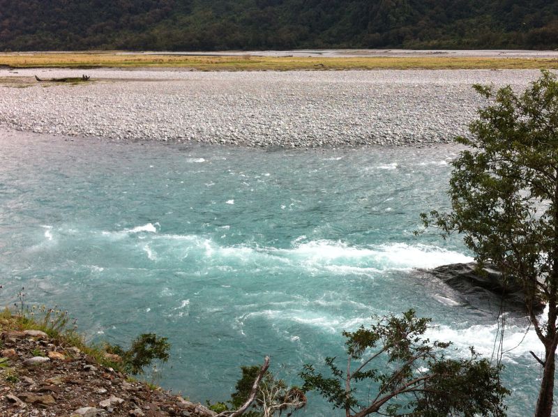
Rural landscape in Haast
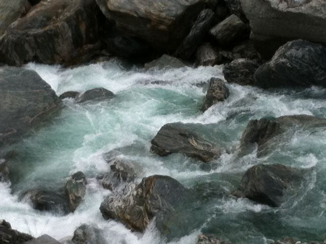
This is the Haast River flowing in a deep gorge surrounded by thick rainforest. The river water is crystal clear, cold mountain water running from the Southern Alps. In autumn there’s very little water but probably much more in the spring, at the time mountain snow melts away.
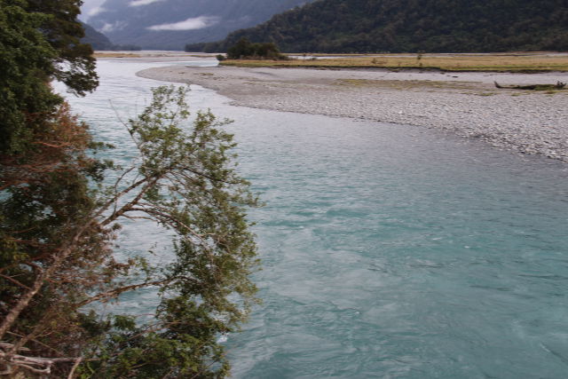
So we followed the Haast River and left the coast behind. The first stop on our drive from West Coast to Queenstown was Thunder Creek Falls.
Thunder Creek Falls

Mount Aspiring National Park: Thunder Creek Falls
The Thunder Creek falls are located in one of the many river bends along the road.
The place is well marked and right off the State Highway, you just have to find your way through a small forest. The air down where the river flows is cool and humid and there’s a spray coming from the misty waterfall.
The Thunder Creek waterfall is a high one, the water drops 96 meters. This really looks like a national park!

Thunder Creek, New Zealand’s South Island
Mount Aspiring National Park
Mount Aspiring National Park is New Zealand’s third largest in size.
The mountains offer a lot of outdoor activities, mainly connected to hiking, biking and climbing. The highest peak is Mount Aspiring, 3030 m. The top of Mount Aspiring is pyramid shaped and looks like the European Matterhorn.
Gates of Haast Bridge

Driving from West Coast to Queenstown: Gates of Haast Bridge
The road winds up to our next stop: the Gates of Haast Bridge located at a high altitude with the wild Haast River below it in the deep gorge. This all is backed by the 2500 m Mount Brewster. And of course this bridge, too, is narrow and you will have to watch for oncoming traffic:
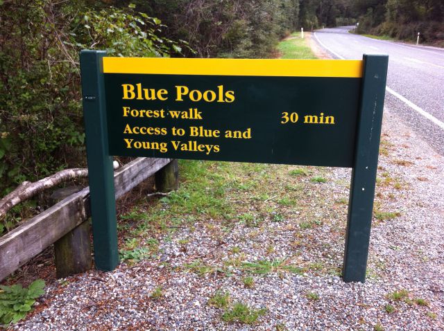
Up we went, being after a short drive surrounded by stunning arctic vegetation. There was the Blue Pools car park from where it’s a short walk to the famous pools:
The Blue Pools
What to see on the West Coast to Queenstown drive: the Blue Pools
The Blue Pools Walk is short 30 min hike through an ancient forest. Even when the forest is located high up in the mountains it contains old, exotic plants that make you feel you are in a fairy tale.
We really loved the short Blue Pools Walk and the fairy-tale forest. Never seen anything like this!

Blue Pools suspension bridge
There are a couple of suspension bridges across two crossing rivers. You will first cross a wide and shallow river that has the same color as the blue pool. The second bridge is where the Blue Pools, the sight is.
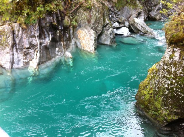
Look at these fresh, ice cold mountain pools, they simply look fantastic! And so BLUE. Would like to swim but the water is ice cold, not much more than +6 C , just like the air. You can tell you are at a high altitude.

The Blue Pools Walk takes you through an ancient forest
The Blue Pools are just north of the village of Makarora, in an area that has other great arctic walks as well.
You can see the other walks marked on the map where also the most interesting waterfalls are marked.

Mount Aspiring and Blue Pools hiking map
To enjoy the great nature of Mount Aspiring National Park you should stay here for some more time. We, however, couldn’t, we had to drive on.
We only had time with one more short hike, the Cameron Creek Lookout Walk before taking the State Highway 6 down towards Lake Wanaka.
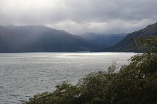
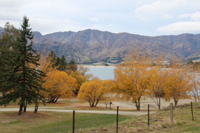
Lake Wanaka

Drive from Haast to Queenstown: Lake Wanaka
Oh how it looks like autumn! – It is autumn and yellow leaves in the mountains. It’s that time, the end of April.
Lake Wanaka autumn views
Until now, we have only seen rainforest in New Zealand. Rainforests stay green all year round and here we got autumn colours! Or has the best foliage already gone at these altitudes? The colours are so mild and nature is already turning brown. But of course even brown shades look nice.

State Highway 6 along Lake Wanaka
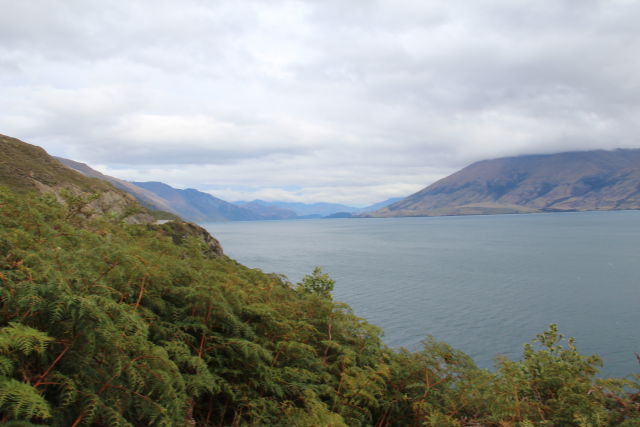
Lake Hawea

The next lake: Lake Hawea
The State Highway then takes you to the next lake, Lake Hawea. Even on a cloudy day Lake Hawea looks stunning. It should have bright blue waters which you won’t see today.
The lake is very deep in places which you don’t see either. Deep lakes like this are good for fishing.
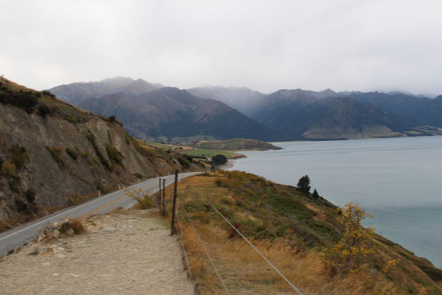
There are many beautiful places where you could camp around the lake and I would like to stay. There is a holiday park too, the Lake Hawea Holiday Park. It’s at the lake’s south end.

The small town of Hawea on the South Island of New Zealand
The little town of Hawea is the only community of any size in the region, before Wanaka.
Lake Hawea Holiday Park north of the town of Hawea

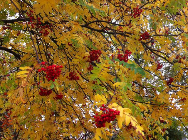
Sheep and autumn colours
Wanaka

Drive from Haast to Queenstown, the south part of Lake Wanaka
And then we once more turned west to Lake Wanaka – towards the pretty town of Wanaka.
Wanaka is a small town, too, but a way bigger than all other towns and villages we have been to on our drive from the West Coast to Queenstown. Wanaka is one of the area’s, Otago’s, most popular holiday resorts. Since its location is stunning and the region around it offers great outdoor activities.
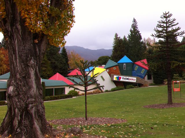
In summer there are the lakes and the tracks to walk or mountain bike, and in winter you can ski in the winter sports areas. And Wanaka itself has a tourist trap: the Puzzling World with crooked houses.
Which Road from Wanaka to Queenstown?

Wanaka to Queenstown along the Crown Range Road
From Wanaka to Queenstown there are two alternative itineraries, the 114 km long Cromwell road and the 67 km Crown Range Road via the Cardrona Valley.
On the way down (this post) we took the longer Cromwell road and returning from Queenstown we took the Crown Range/Cardrona Road.
You can read about our return trip via Cardrona on another post Queenstown to Mount Cook via the Cardrona Road. The post also contains more information and photos of the surroundings of Wanaka.
Cromwell Road Fruit Gardens

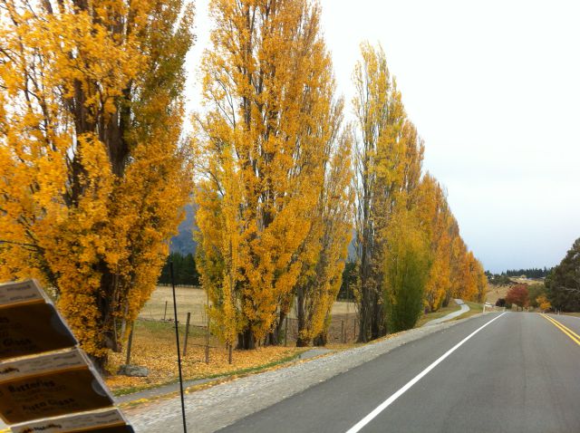
Cromwell Road from Wanaka to Queenstown: peach trees
The Cromwell road from Wanaka to Queenstown follows rivers all the way. The road first runs on the west side of the Chlutha River and then winds down into Kawarau Gorge.
As the valleys south of Wanaka have protecting mountains on both sides, they get an exceptional, mild climate. That’s why wine and fruit trees grow in these river valleys high up in the mountains. The route we are following is the Cromwell Wine Trail, a marked tourist route.
Fruit gardens north of Cromwell must look great at all times of the year, but maybe most of all in autumn! Just look at all these peach trees in neat rows:

Nature turning from green to yellow

New Zealand peach leaves in autumn

Cromwell area peach trees in neat rows
You can choose which side of the river and Lake Dunstan to drive on, there are good roads on both sides. We took the shorter road west of the lake.

The artificial Lake Dunstan, New Zealand South Island
Old Cromwell

Cromwell Road from Wanaka to Queenstown: Old Cromwell
New Zealand locals know Cromwell as a historic town that has an unusual history.
When they built a dam in the river to create the artificial Lake Dunstan, the water expanded too much and drowned the old town of Cromwell. However, there was a way to save the historic old town quarters: they were moved to another place, to the new lake shore.
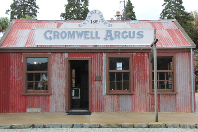

And here they are, in their new location! Old museum buildings, artisans workshops, shops, stores and cafes.
Kawarau Gorge

The road from Wanaka to Queenstown: Kawarau Gorge
After Cromwell there are mountains and more mountains. Vineyards and more vineyards. We are driving along the rugged, brown Kawarau River valley and have snow-capped mountains on both sides, and a ski field at distance, the Remarkables ski area.

Central Otago vineyards and snow-capped mountains

Kawarau Gorge and a river with the same name

Kawarau Gorge vegetation
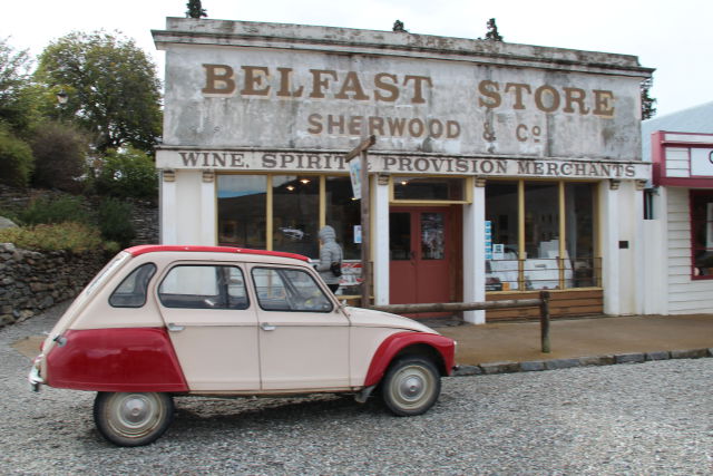
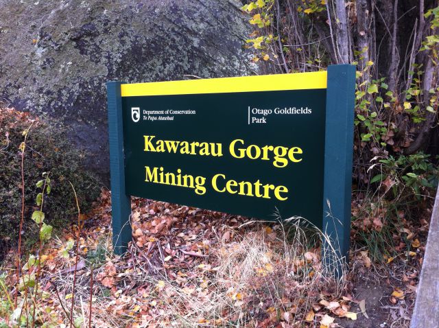
Goldfields Mining Centre

The Kawarau gorge from the Goldfields Mining Centre
The Kawarau gorge was first settled some 100 years ago, by gold seekers, and there still is some gold waiting to be found.
At the Goldfields Mining Centre just off the main road you can try gold spanning and learn about the hard life of gold miners. And even better, they have preserved an authentic gold mining village. A nice spot for a stop on the long drive!
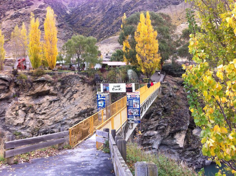
Almost next to the Gold Mining Centre is an old bridge that they built long ago to get across the river, the Kawarau Gorge suspension bridge.
Kawarau Gorge Suspension Bridge

The Kawarau Gorge suspension bridge
The 43 m high Kawarau Gorge suspension bridge was built in the 1880s for better access to the nearby goldfields. Then, in the 1960s it was replaced by a new concrete bridge.
Today only hikers and mountain bikers use the old bridge to cross the river – and bungy jumpers.

Kawarau Gorge bungy jumping bridge
Did you know that Kawarau Gorge Suspension Bridge is where bungy jumping started?
In 1988 two New Zealand bungy pioneers launched the world’s first commercial bungy jumping site off this bridge. Their company AJ Hackett Bungy still works with bungy jumping and Kawarau Gorge bungy jumping has become a phenomenon.
To try the original bungy jump, you can come here on your own transport or take an organized tour from Queenstown. There are many tours to choose from.
If bungy jumping interests you, read more here: Kawarau Bungy Centre

Kawarau Gorge bungy jumping

Jumping off the historic Kawarau Bridge

Hanging half-way in the air. Not a water touch this time.
Towards Queenstown

Driving from Wanaka to Queenstown: Kawarau Gorge vineyards
The last ten or twenty kilometres before Queenstown are a wine growing region. In this spectacular place we suddenly got some evening sunshine!
It all looked so great that we had to stop a lot and have a closer look at the vines. I wanted to talk with the owners to ask about their wines, but they were not around.
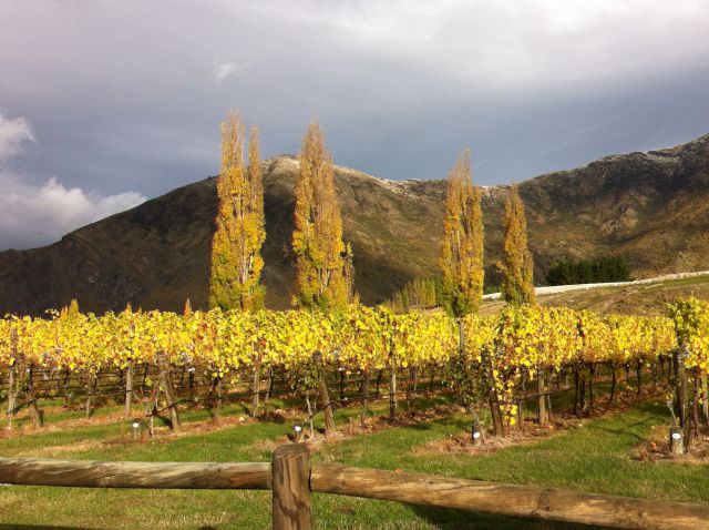
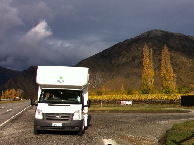
Kawarau Gorge vineyards
Then comes a bigger road crossing, the Arrow Junction where the Crown Range road from Wanaka joins. To read about the Crown Range Road see the post Queenstown to Mount Cook via the Cardrona Road). The same place is the turn off to the old gold mining town of Arrowtown.
After this follows the much photographed Lake Hayes – and we are in Queenstown!

Queenstown, New Zealand
More about Queenstown
For more information on Queenstown, see these posts:
- Beautiful New Zealand: Queenstown Walk in Photos
- Queenstown Day Trips by Car: Arrowtown and Lake Wakatipu

Queenstown and Lake Wakatipu, New Zealand
To continue your journey from Queenstown, check out the post Queenstown to Mount Cook via the Cardrona Road.
More on New Zealand Travel
This was section number 4 of our New Zealand South Island road trip. You will find all other sections on the road trip main page:

Campervan trip on New Zealand South Island