To see the highest mountains in Gran Canaria we took the winding road to the top of the island where some peaks almost reach to 2000 m.
In addition to the highest mountain Pico de Las Nieves, the island’s green center contains the historic landmarks of Roque Nublo, Cruz de Tejeda and Roque Bentayga – and old villages, among them Tejeda looking into a caldera.
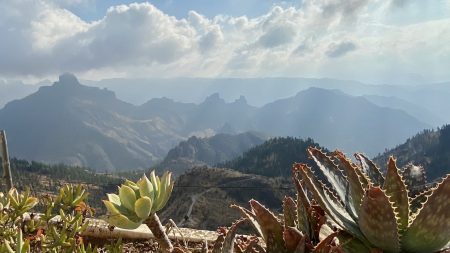
In the highest mountains you will feel like you’re in a painting:

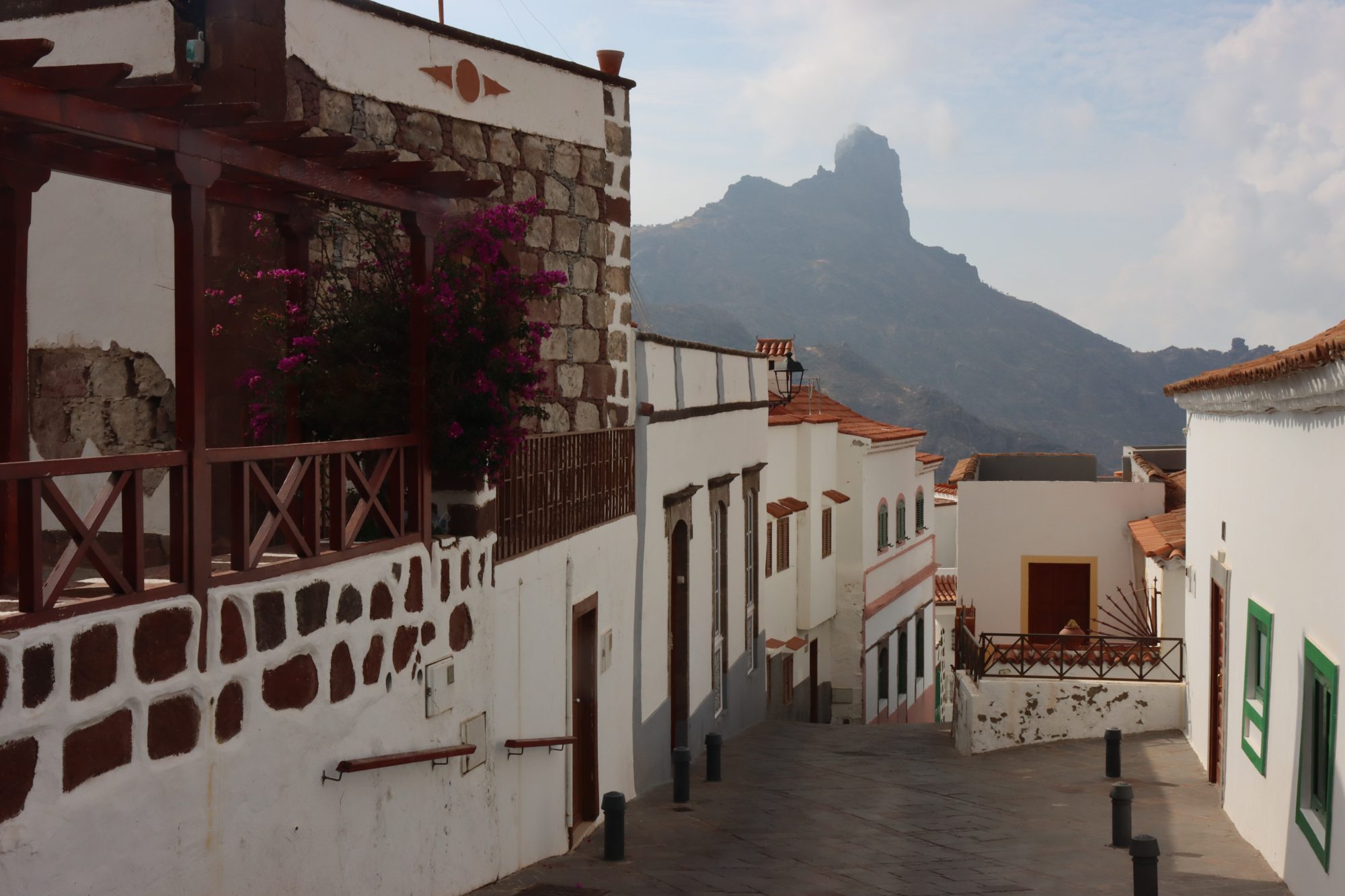
View like a painting: Tejeda and Roque Bentayga
In addition, on the way up there are lakes like Presa de las Ninas with many hiking options.
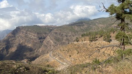
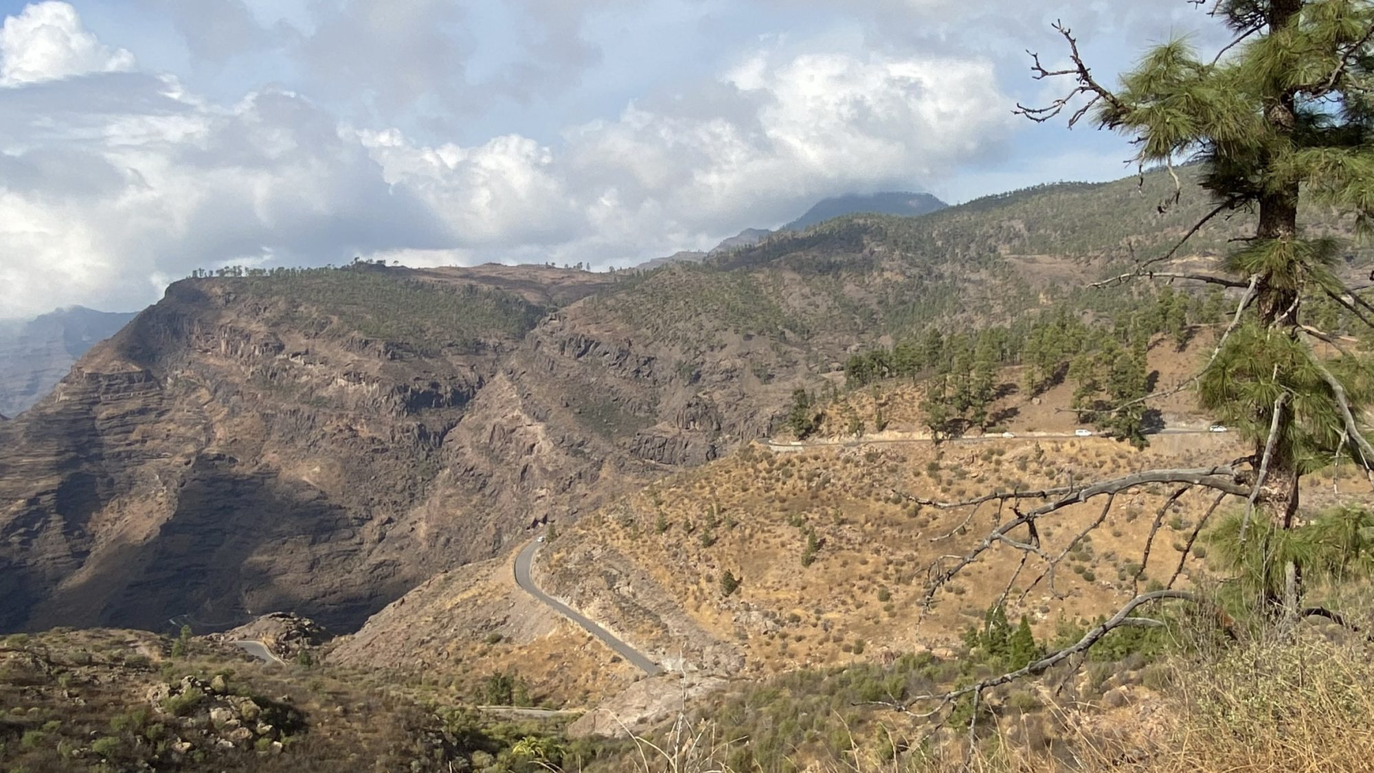
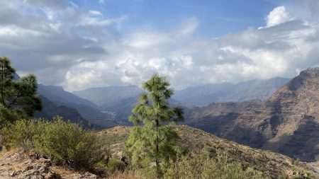
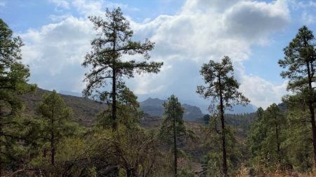
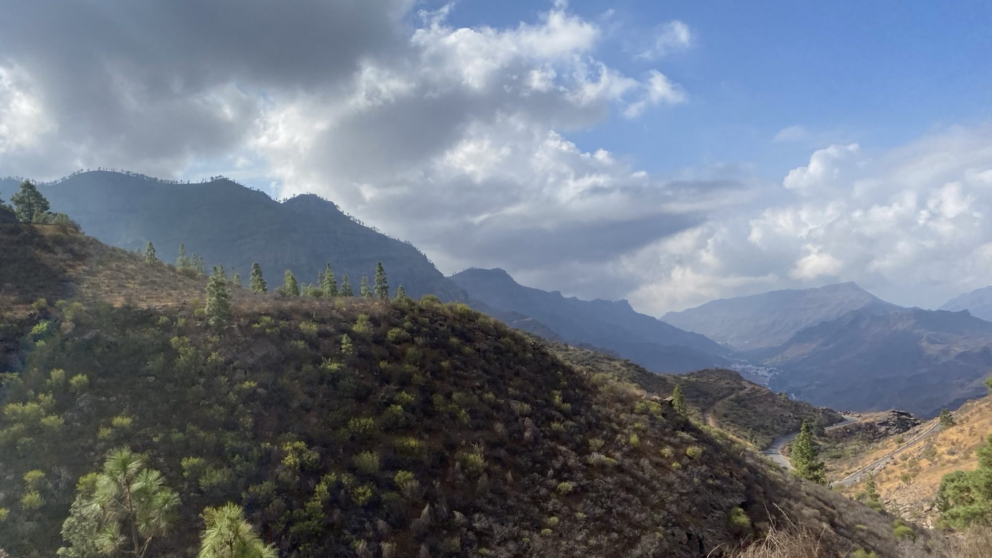
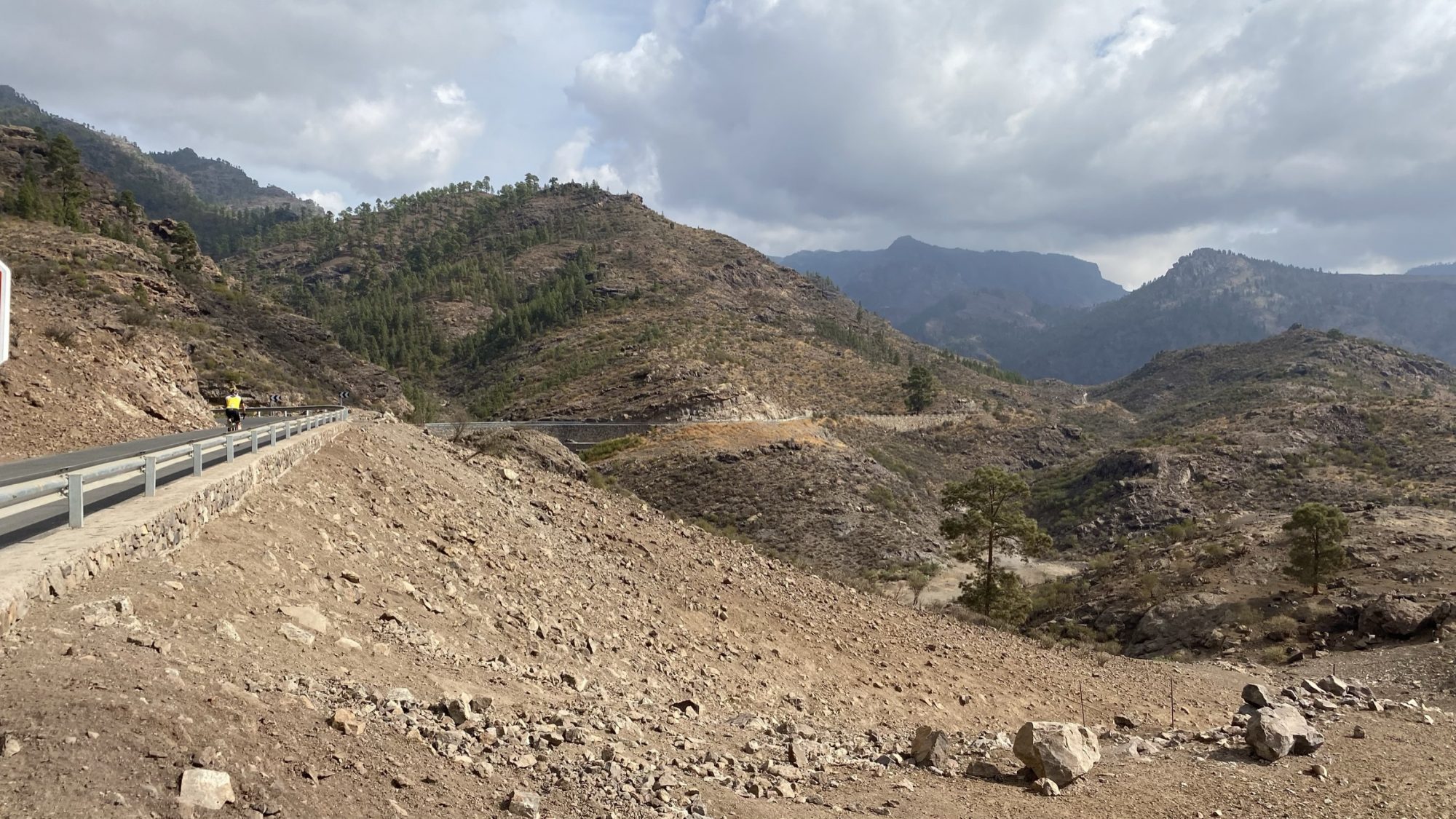
The best sight, however, is the mountain landscape in itself. The deep ravines and sharp ridges, the terraced fields and sub-tropical slopes.
Welcome to the high center of the holiday island! Let the sun shine when you visit.

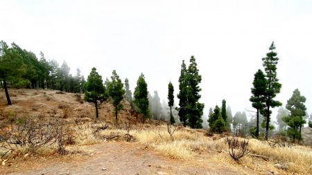
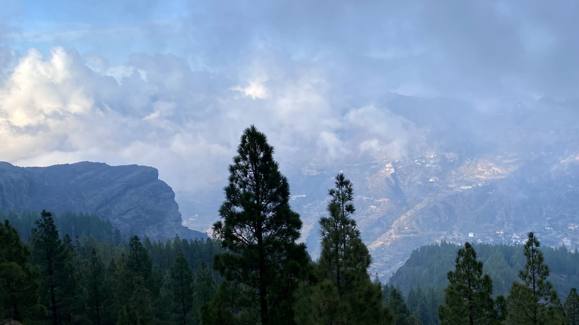
Sun and clouds, the weather elements in the Canarian mountains
The sun and clouds together make a striking combination.
In the heights you literally stand in the clouds. The soft, white clouds sweeping by are close enough to touch. Then comes the sun and you can see its rays through the mist. It’s a magic view when the whole landscape shines!
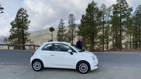
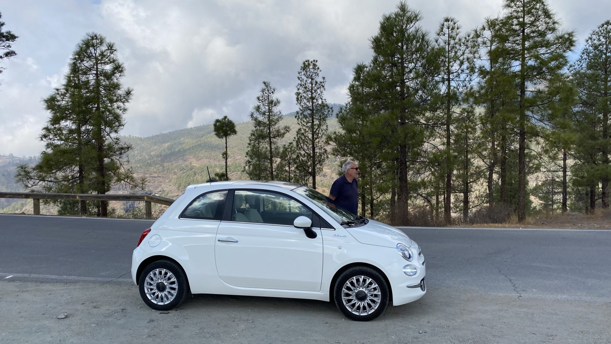
To see the sun and the clouds and all these destinations, we hired a car and went to the mountains:
The Highest Mountains in Gran Canaria: Driving Map
We took the super scenic Mogan road up, long, curved and winding. The other option from the south coast is the road from Maspalomas.
From Las Palmas, to get to the highest mountains there’s the Santa Brigida – Vega de San Mateo road or the one via Teror.
Map of the drive to the highest mountains in Gran Canaria
To from Mogan to Artenara is 60 km and takes about 2 hours one way, and then of course the same back. Staying close to Puerto de Mogan we took the same road back, but a good alternative is to return to Maspalomas via San Bartolome de Tirajana.
We finally spent the whole day in the mountains, from early morning till late evening. Which meant the drive back was after dark, for which purpose the Mogan road was perfect as there were no other drivers at that time.
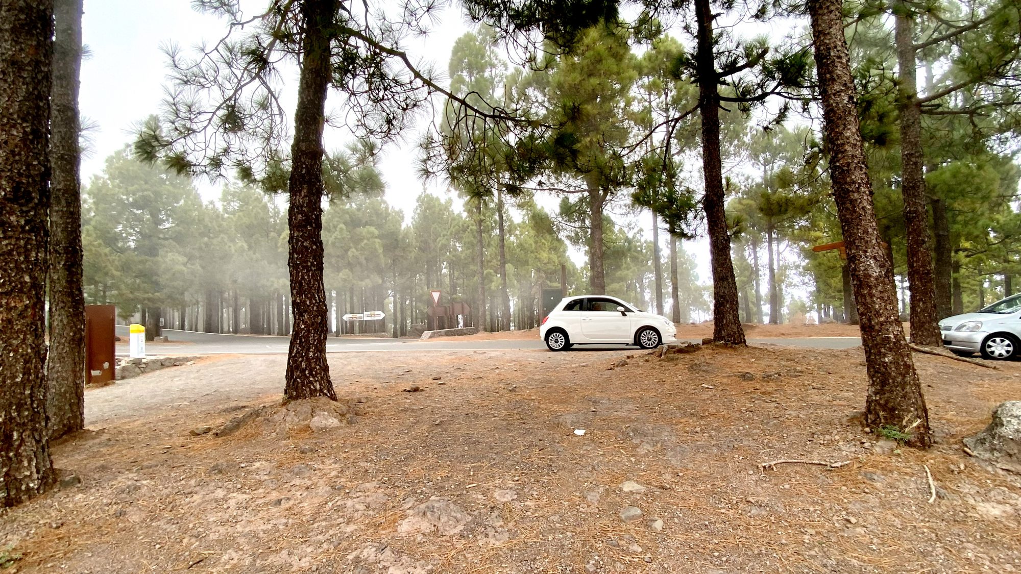
Here we are, among cactuses in the mountains:

On a day trip to the high center of Gran Canaria
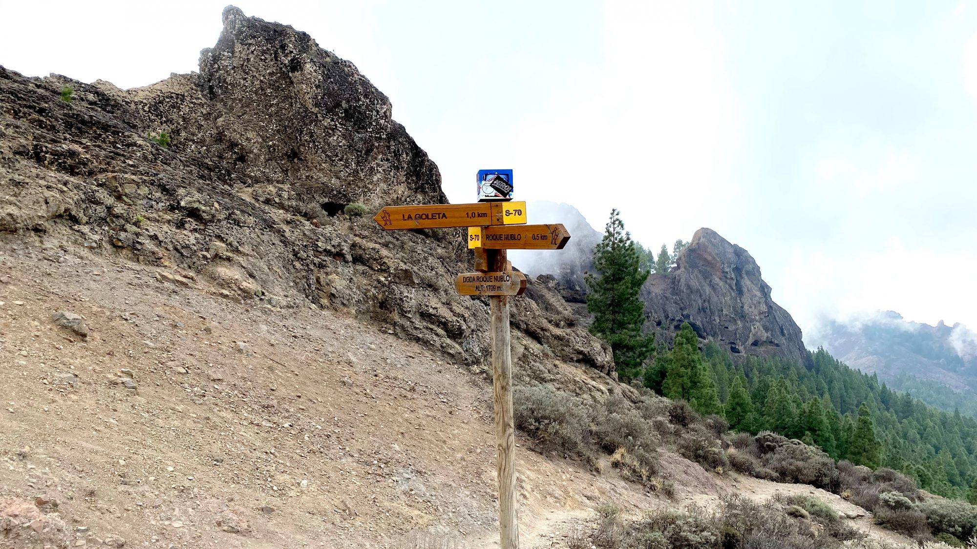
On the map you can see the location of Roque Nublo. You will almost get there by car, only a short walk is needed to reach the top. To Pico de las Nieves there’s a road all the way up.
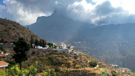
From the Pico the road winds on in the heights, along a ridge that splits the island in two. On that ridge are Cruz de Tejeda and Artenara, while Tejeda is lower down in an 18 km wide crater.

Tejeda in a crater
Now let’s get on the road:
From Mogan to Mountains

Drive into Gran Canria’s highest mountains by rental car
After we left behind the busy inland village of Mogan it all changed. Quiet and beautiful, no traffic, just birdsong. As we were the only ones on the road we were free like birds and could stop just where we liked.
Photos from the roadside:
-
- The road from Mogan to La Cumbre
-
- View back to Mogan

-
- Stopping for a lake viewpoint
-
- Thick Canarian pine forest

-

- Sunny hills and mountains
-

- Road to Ayacata, La Cumbre
Click on the small photos to open them up in a slideshow
So we enjoyed the freedom and stopped at all possible road bends, breathed mountain air and took take in the views!
Our destination, the highest mountains in Gran Canaria also called La Cumbre, was still a long drive ahead but even this was good enough for us!

Scenery from the drive to La Cumbre
Nevertheless, we decided to not stay here but drive on and the next thing we met was a wooded region with mountain lakes. Among the lakes Presa de las Ninas was the one that appealed to us the most:
Presa de Las Ninas

To the highest mountains in Gran Canaria: Presa de las Ninas
Even when it doesn’t look like that, Presa de las Ninas is an artificial lake, one of the many on the island. The lakes where built to gather water for the island that gets too little rain. Read about another man-made lake in Gran Canaria, La Sorrueda.
A mountain lake surrounded by pine forests is not what you expect to see in the Canary Islands, but now we have seen one. Just like in California, Norway or Canada.


Presa de las Ninas, an artificial lake in Gran Canaria
Presa de las Ninas with its hiking trails, picnic areas and camping sites is a place loved by the local population and they fill the forest trails at weekends. If you want to visit, do that mid-week.
Into the Highest Mountains of Gran Canaria

To the top of the island: Ayucata, a village below Roque Nublo
The road went up and we came to Ayacata, a small Canarian village that has becom a center of outdoor activities. As a result of a growing interest in hiking and mountain biking.
Ayacata is located right below the Roque Nublo and a trail takes you from the village to the famous rock. It’s a pretty steep climb up the mountain side and in addition there’s a shorter hike from La Culata a bit further on.
So we drove on to La Culata to hike from there, only to notice that there was nowhere to park. Miles before and after the roadside was full of cars and we just we had to skip Roque Nublo and try to come back later.
You can tell that the shortest Roque Nublo hike is the most popular in Gran Canaria.


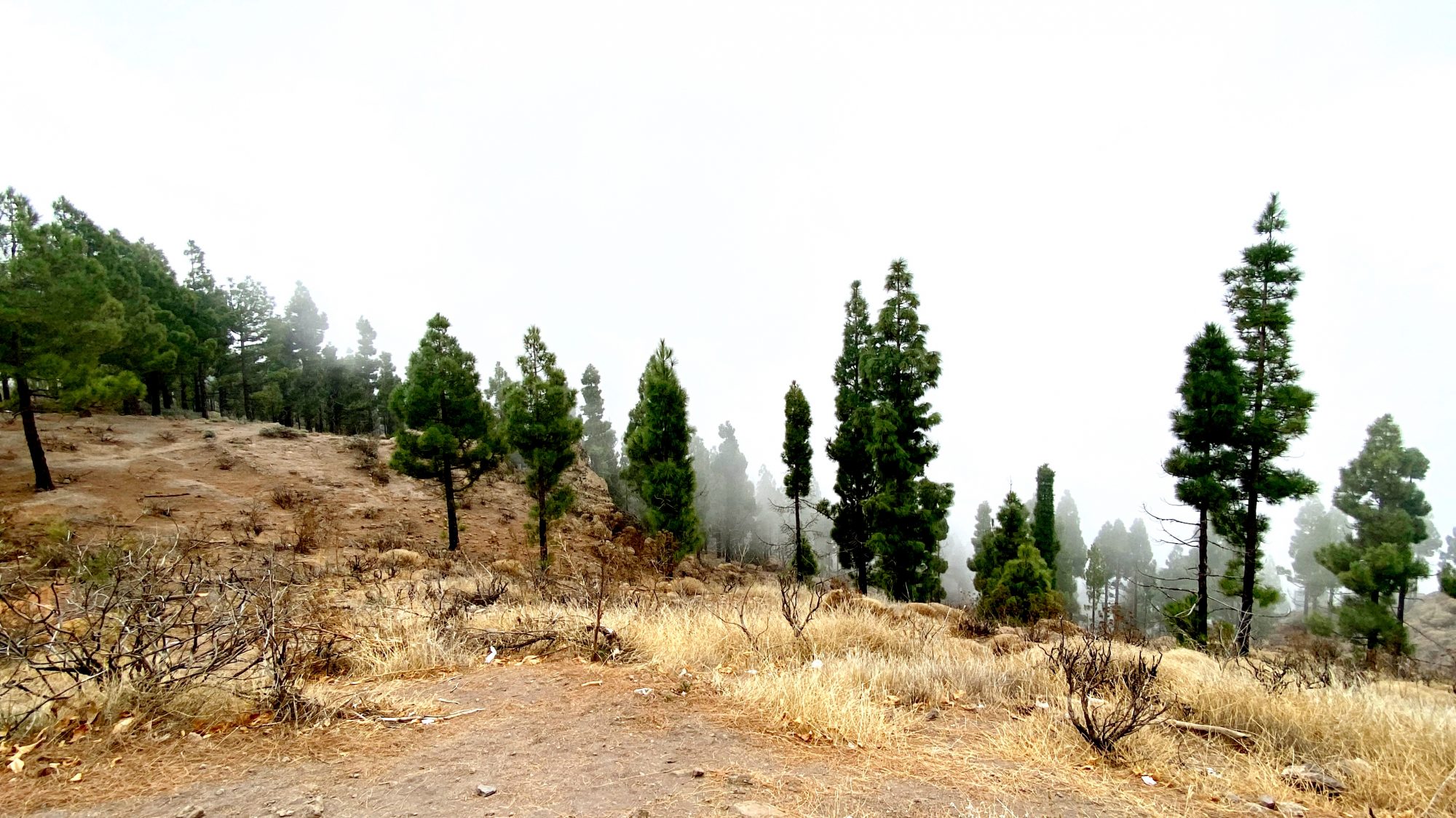
Llanos de la Pez, picnic area and pine forest
The top of Gran Canaria is characterized by large forest areas. The wonderful green, high pine lets the light come through and smells so good!
The lower photo is from the Llanos de la Pez picnic area right on the roadside.
The area has a large number of massive picnic groups spread around the forest, a kiosk and toilets. It’s also the starting point for many hikes, either up to Pico de las Nieves or in other directions, like the Camino Santiago de Gran Canaria.
The hike Llanos de la Pez to Pico de las Nieves, 6,8 km at AllTrails.com
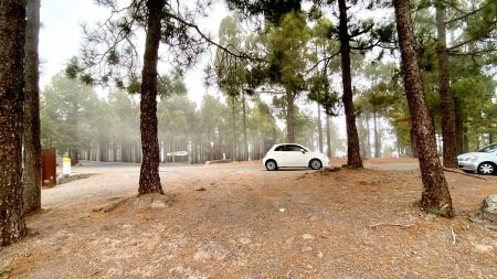
Pico De Las Nieves
We, however, didn’t go hiking here either but took the road to the top of Pico de las Nieves. Sunny and nice, the road looked like this:

The road to Pico de las Nieves
The weather was perfect and we were anxious to see the whole island below us, but what did we see?
Nothing, simply nothing. For some reason there where thick clouds hanging all around the top and absolutely no visibility wherever we tried to look:

No visibility today at Pico de las Nieves, Gran Canaria
Without any clouds the 360 degree view from the top is said to bee spectacular with the whole island below you and the neighbor islands further away.
-
- Pico de la Nieves top
-
- Pine forest

-
- Driving to Pico de las Nieves
Pico de las Nieves is 1949 m. high and the name peak of snow says it might be snow-capped in winter.
At other times of the year the Pico draws all clouds to it from the region like a magnet, particularly in afternoons. That’s why morning normally is the best time to come.
So for us there was nothing to do but drive back down through an autumn forest that looked like the ones we have back home in the north:


Pico de las Nieves: no snow, no sun – but great autumn colours!
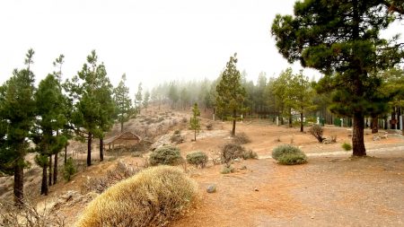
Then, the next place to stop was the viewpoint in the Degollada de Becerra:
Degollada de Becerra


Degollada de Becerra where footpaths cross
The lookout of Degollada de Becerra is at an altitude of 1550 m and literally in the clouds. But it can change rapidly as clouds come and go. At whiles there’s a thick fog, and after a second a fantastic panorama may suddenly open up.
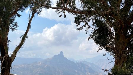
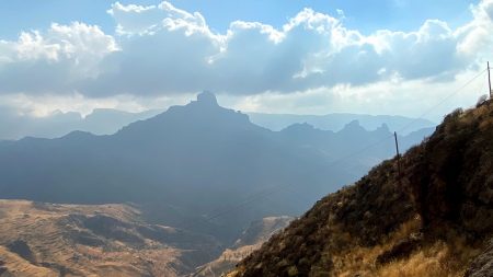
From Degollada de Becerra you can see the whole west part of La Cumbre: Tejeda, Artneara – and in the center of it all the ancient fort of Roque Bentayga:
Roque Bentayga


Gran Canaria mountains and the historic Roque Bentayga
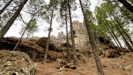
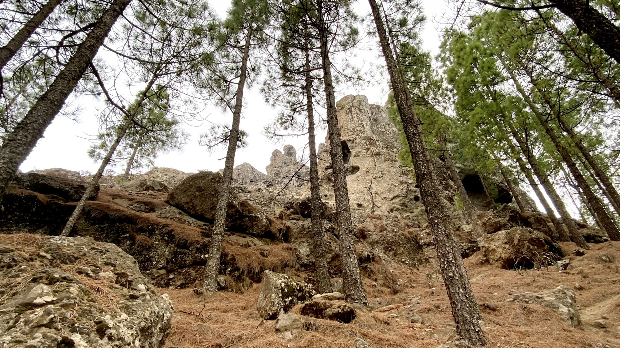
Roque Bentayga is a prominent rock that rises to 1412 m above sea level. For the Guanches, the original people of the Canaries, it was a holy place and a ceremonial site and they also lived in caves in its slopes.
The holy rock can be seen from all over the region, even from the coast if you know where to look for it.
From Tejeda there’s a road to Roque Bentayga so you can go and see the rock at a close distance, as well as the old caves in its slopes.
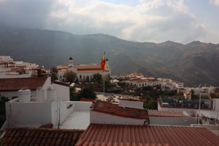
Cruz de Tejeda

Cruz de Tejeda marks the central point of Gran Canaria.
Even when the Roque Bentayga centers the mountain region, the historic center of the island is the massive stone cross standing on a mountain pass.
The cross, Cruz de Tejeda is the place where all roads across the island meet and from where you can get north, south, east and west.
At the time the cross was built there were no roads, only footpaths used by kings called caminos reales. The caminos reales were the only way to get across the mountain island. Today these paths still exist, steep, stone-paved and dramatic.
The Camino Santiago of Gran Canaria
Still today you can follow the old royal trails, the most famous of which is Gran Canaria’s own Camino Santiago along an old pilgrim footpath.
The camino stretches across the island and in the highest mountains you can walk sections of it along a super scenic footpath that crosses the road at many points.
See how beautiful the Camino Santiago trail looks like in the highlands at Wired For Adventure.


Cruz de Tejeda in the center of Gran Canaria
The historic stone cross is located in the small village with the same name Cruz de Tejeda, one of the few locations in the highlands that have restaurants, souvenir shops and other tourist services.
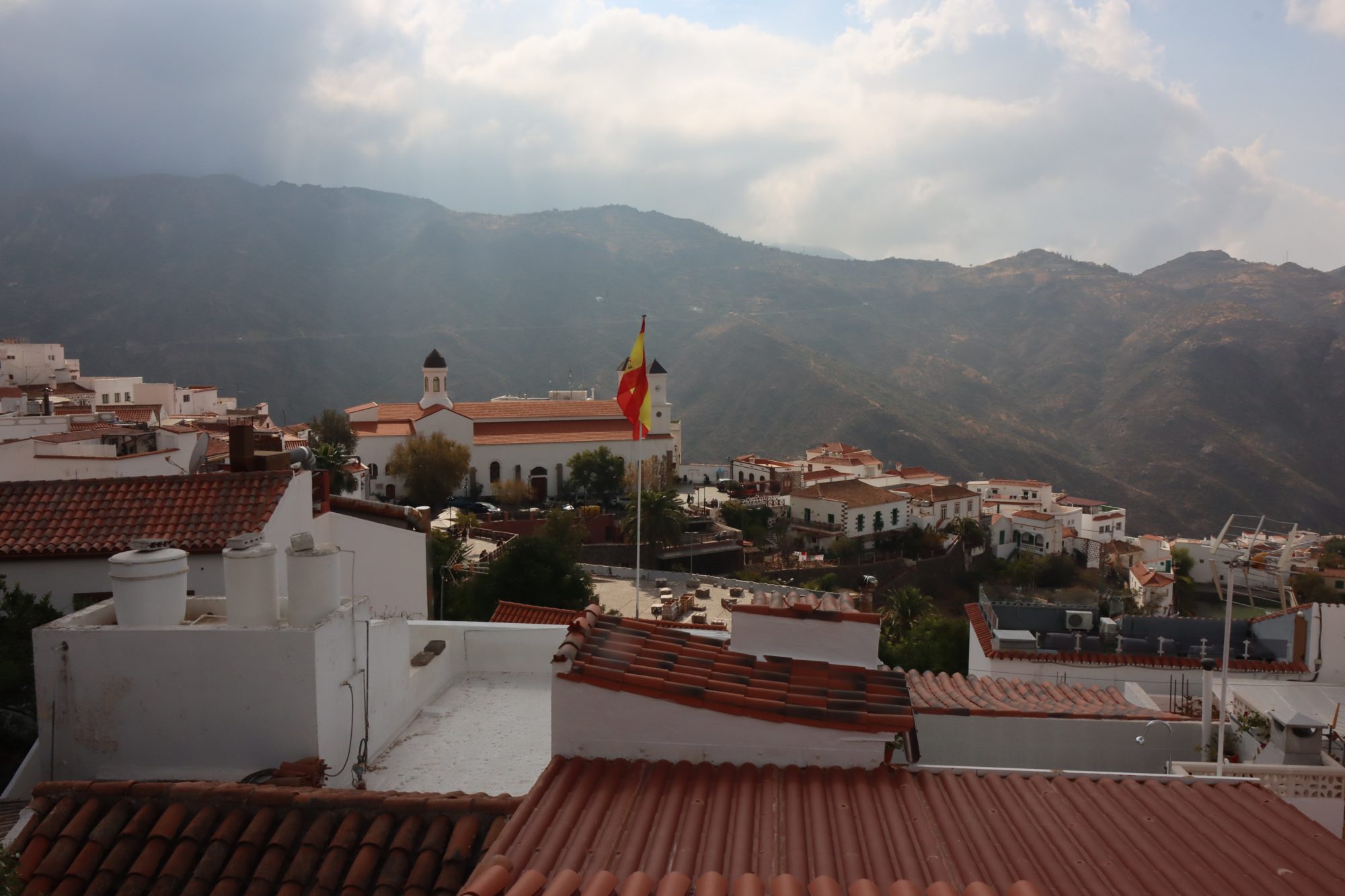
Views around the Cruz de Tejeda:
-
- Roque Bengayga seen from Cruz de Tejeda

-
- Slopes below Cruz de Tejeda

-
- Roque Nublo behind the clouds

-
- The caldera from Artenara road
-
- Mighty Canarian mountains

-
- Mountain view from Cruz de Tejeda

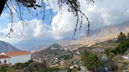
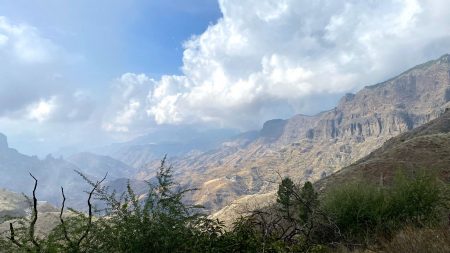
From Cruz de Tejeda we winded down to Tejeda and on to Artenara along the caldera wall. A fantastic crater drive in a fertile farming region.
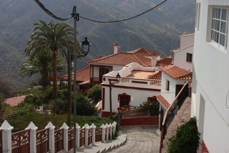
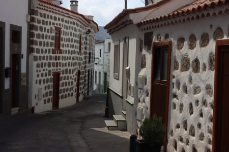
What about Tejeda? The quiet little town turned out to be even prettier than we thought:
Tejeda


Tejeda, Gran Canaria
The historic town of Tejeda sits in a scenic location in the massive crater Caldera de Tejeda that is one of the most prominent features of the whole region. Below the village is the crater’s steepest point, the gorge of Barranco de Tejeda that splits the crater in two.
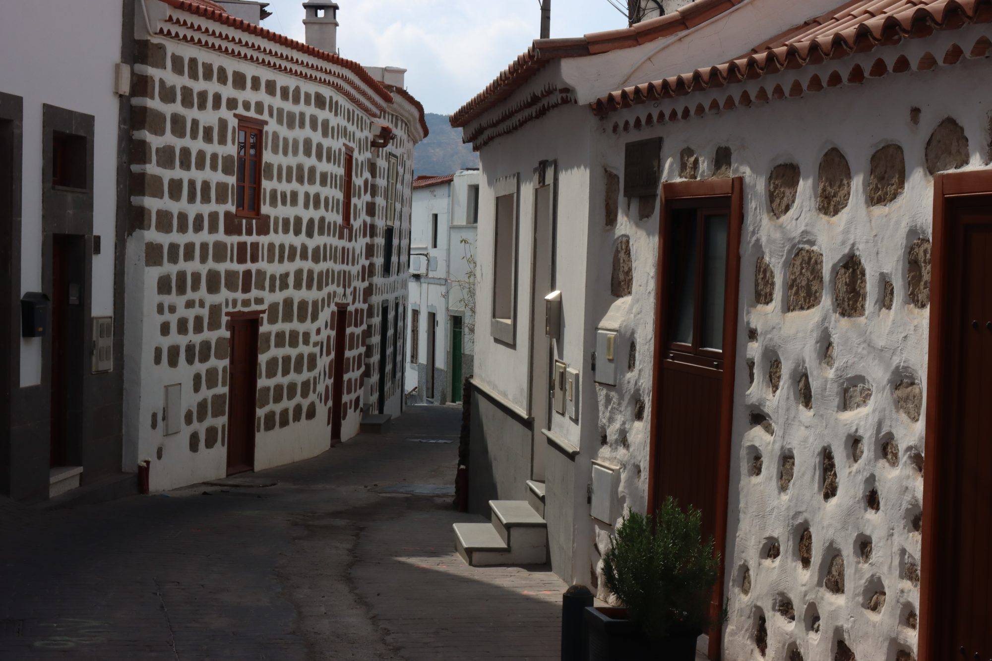
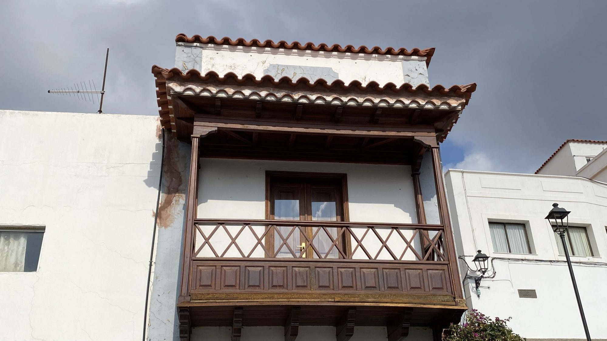
Tejeda’s atmoshpere in photos:
-
- Tejeda, Gran Canaria

-
- Old stone buildings of Tejeda
-

- A wooden balcony
-
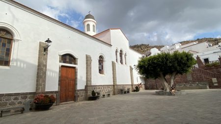
- La iglesia

-

- Tejeda and Roque Bentayga
-
- The white village of Tejeda
The surroundings of Tejeda are like from a postcard, would really love to stay few days on the trails. There are many of them in the region, good ones.
As a typical Spanish white village, pueblo blanco, Tejeda contains a parish church on the square, a town hall next to it and a the rest is white houses like the ones in the photos.
For its beauty Tejeda is a favorite stop for tourists to whom a range of shops, restaurants, cafes is offered, all of them in too pretty locations to just walk past. There also are some nice museums
And maybe there’s a hotel as well to stay overnight? Not now but next time!


Terraced fields at the edge of a barranco
The Highest Mountains in Gran Canaria: To Artenara
Artenara at 1270 m is the highest located village in Gran Canaria. A feature of the village are the many historic caves, some of which are made to cave houses where people live.
The cave village of course has a cave chapel, Ermita de la Virgen de la Cuevita, it’s at the hilltop, and a cave restaurant, Meson de la Silla.

The road to Artenara, Canary Islands
So Artenara is one of the few places in Gran Canaria where people still live in caves.
Another place is Cuevas Bermejas on the east coast. Read about the east coast cave village in this post: Gran Canaria East Coast Drive: Crater and Caves.


Dramatic scenery from the top of Artenara
Located at a mountain top Artenara enjoys splendid views to all directions. There’s a mirador to the mountains on the north side and another one on the road to Teror where you can see the spectacular Caldera Pinos de Galdar.
Read about the scenic northern mountains of Gran Canaria: Las Palmas Mountain Trip: Gran Canaria’s Scenic North
So Artenara, too, is a road crossing where you can choose where to travel: Teror, Galdar or the Tamadaba Nature Reserve, all in different directions. Or do like us, just turn back.
At Artenara we turned back and had a second try to get up to the mysterious Roque Nublo:
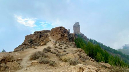
Roque Nublo

Roque Nublo at the top of Gran Canaria
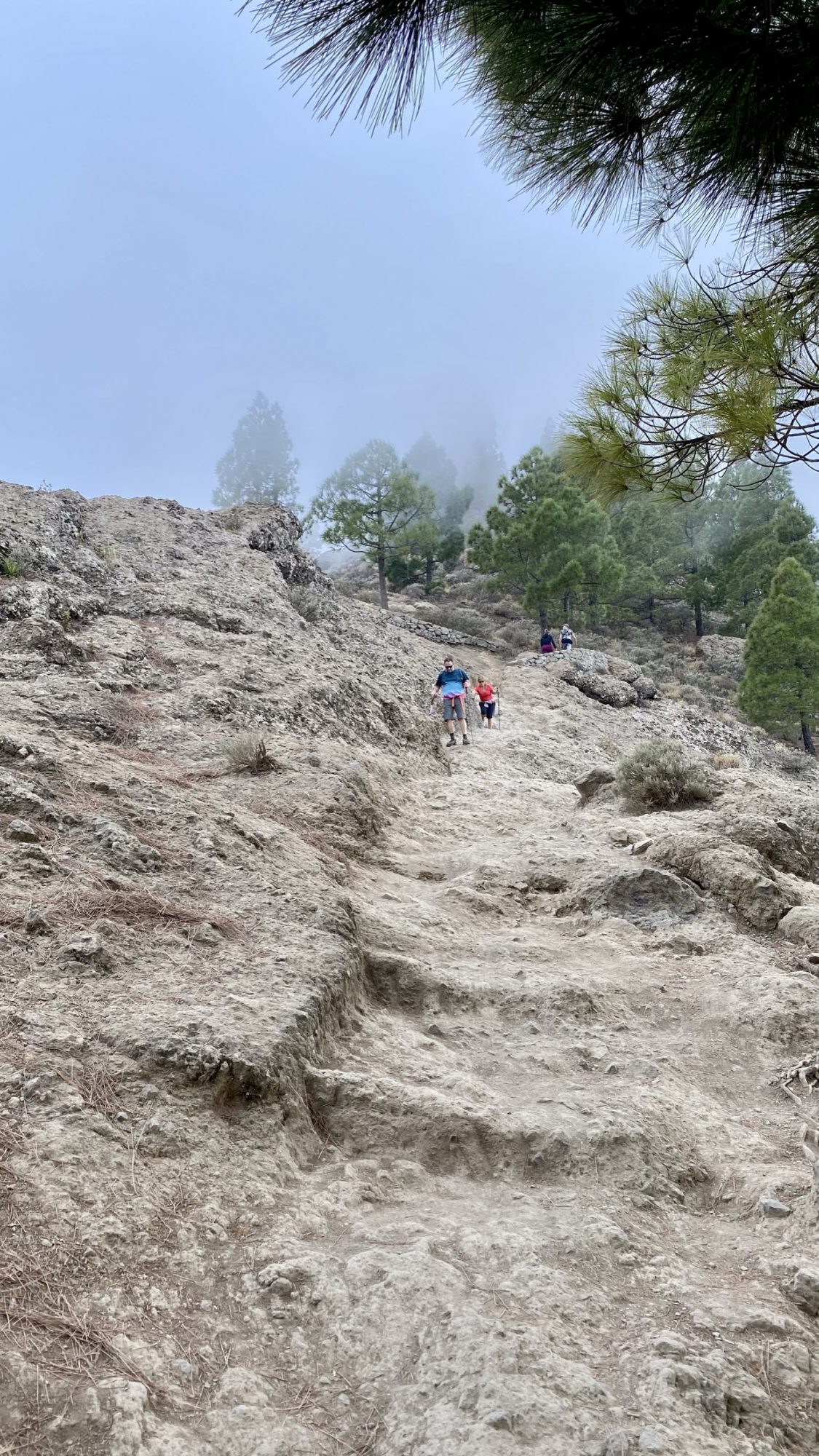
This time we had luck. As it was getting late the crowds were gone and we could just park right were the trail begins. So up we went to the rock.
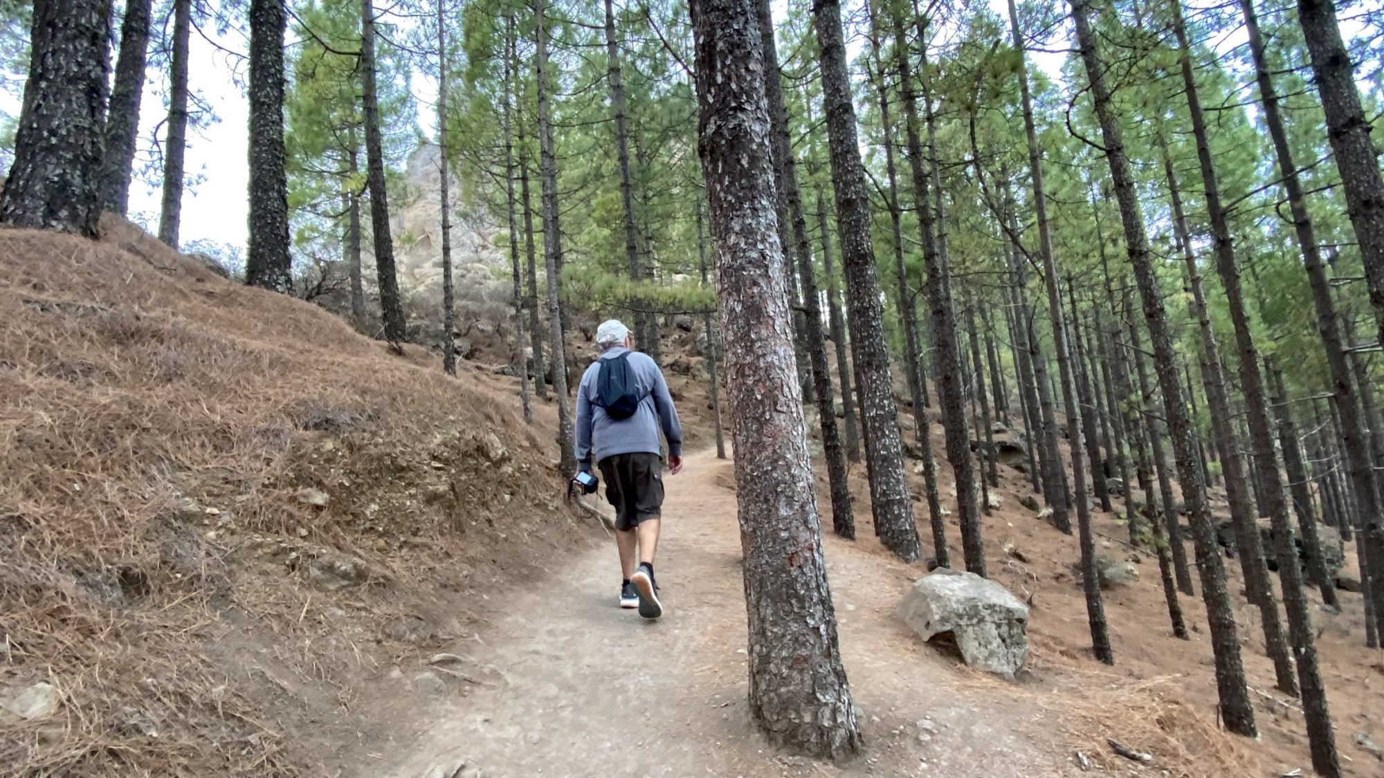
From the car park of La Culata it’s first along an old road, then on a rocky path, at whiles in the woods:
-

- Hike from La Culata to Roque Nublo
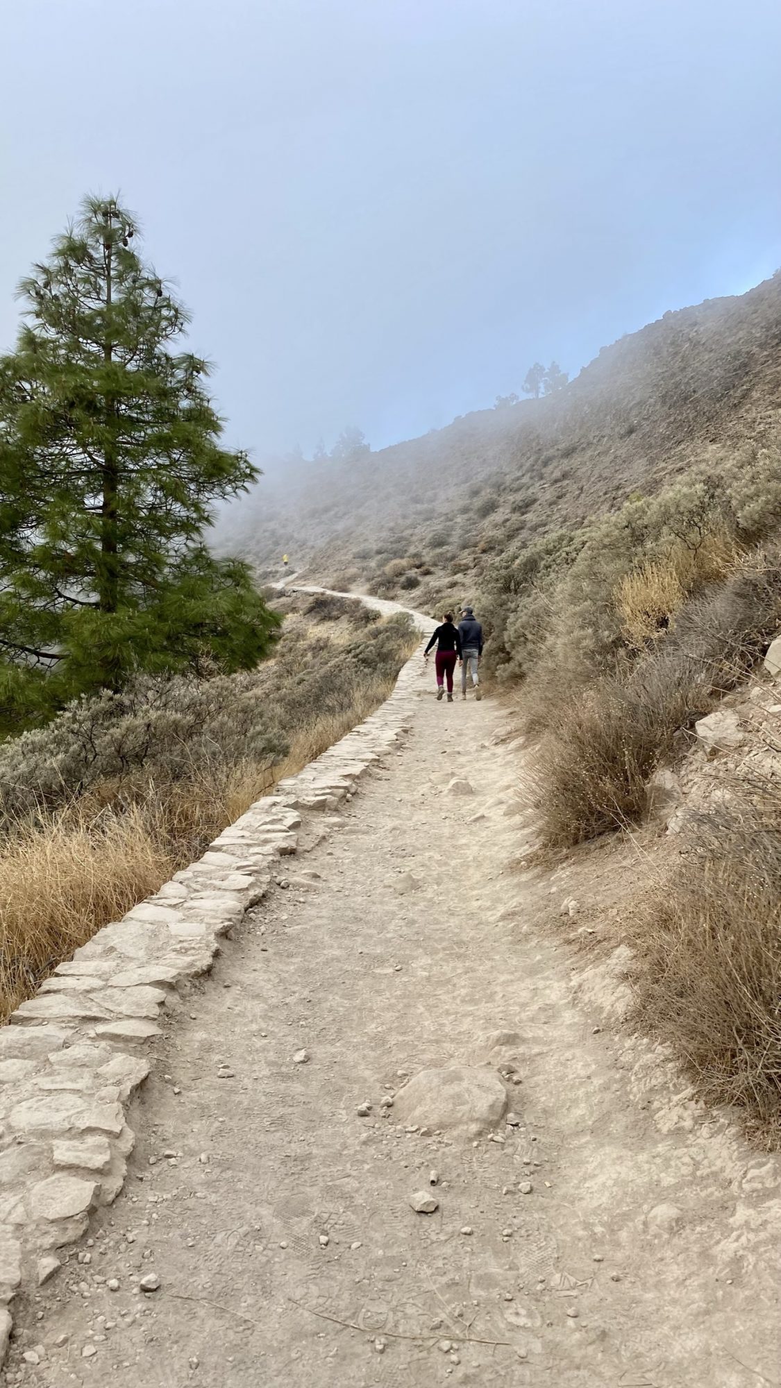
-

- All the way uphill
-
- Strange rocks at all sides
It’s a pretty steep rise and the thin mountain air makes you out of breath. But it’s short as well, only 1,5 km up and back the same.
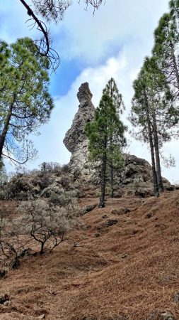
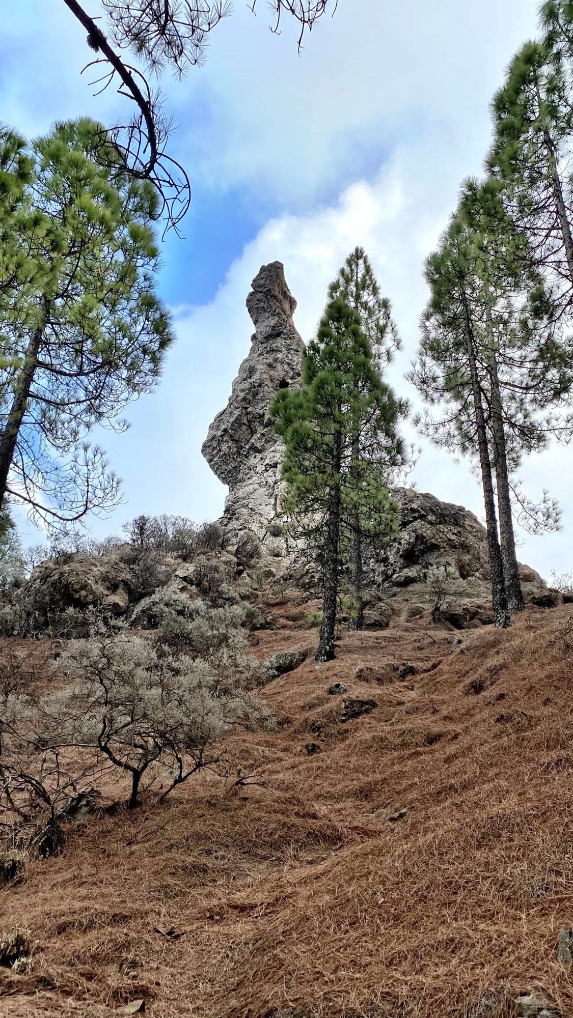
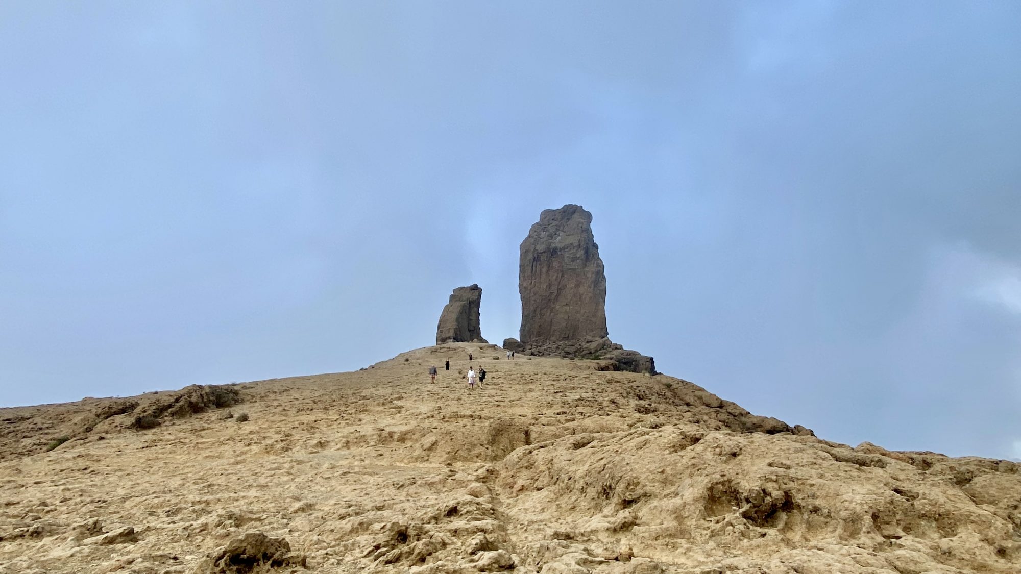
So in a shosrt time we were up on the plateau where strange volcanic rocks exist:


Climbing the Roque Nublo, the icon of Gran Canaria
The Island’s Landmark
The Roque Nublo is the island’s landmark, a huge rock at one of Gran Canaria’s highest points. The location at 1800 m makes that it often hides behind clouds, a fact where the name came from, the cloud rock.
The 70 m high rock looks like a loose stone finger ready to collapse any time, just like the smaller one El Fraile. Yet they have stood there over the last 4.5 million years as remains of a massive volcanic eruption.
A Historic Guanche Site
For the Guanches the cloud rock was a place of worship where they flocked. And still today visitors flock to the rock. They all want to see the sacred rock, or rather the panorama from it. But the tourists are mostly right, and so were the Guanches, there’s a reason to come.
The Roque Nublo hike in photos:
-

- Hiking in Roque Nublo National Park
-

- Roque Nublo trails
-
- Lava on the mountain top

-
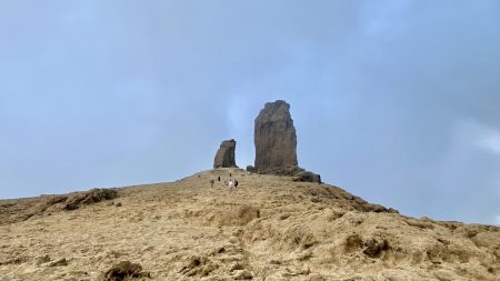
- The plateau and Roque Nublo
-

- View to the Caldera of Tejeda
-
- Strange rocks next to the path
So now you know what we saw when walking to Roque Nublo, and what we saw in the highest mountains in Gran Canaria.
We got to know that the wild center of the island is worth the drive and are glad to recommend the trip.
Conserning Roque Nublo, it was kind of a pity that we only had time with the shortest 3 km hike. The hike was fantastic but shorter than the one we planned to take.
We meant to take a longer hike that first goes around the mountain top and then up to the rock. Or alternatively from Ayacata up. But that, too, next time!
Would you like to read about hiking at the top of Tenerife? Hiking in Tenerife: Day Trip to Mount Teide by Car


At the top of Gran Canaria: Roque Nublo, the rock in the clouds
More about Roque Nublo Trails
- Trail information and map of the 3.1 km Roque Nublo hike at AllTrails.com
- The 5,8 km hike round Roque Nublo and up to the top, AllTrails.com